.jpg)
Typical, very wet vegetation. A on the map. © Sjoerd Mayer.
Typical, very wet vegetation. A on the map. © Sjoerd Mayer.
.jpg)
Don't look down! B on the map. © Sjoerd Mayer.
.jpg)
And it's all sogging wet ... C on the map, looking west. © Sjoerd Mayer.
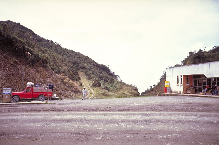
The petrol station at Cotapata (D on the map).
The track leads across the ridge and then zigzags down the other side of the ridge. © Sjoerd Mayer.
.jpg)
Burning in the dry season. There is a gold
mine in the gulley behind the fires. Photo taken from point E on the
map towards the northeast. © Jon Hornbuckle.
.jpg)
Typical vegetation. A on the map. © Sjoerd Mayer.
.jpg)
Typical vegetation. A on the map. © Sjoerd Mayer.
.jpg)
Typical vegetation. F on the map. © Sjoerd Mayer.
.jpg)
Clouds in the valley below. And endless forest-covered slopes: no roads, no clearings. And that so
close to the big city of La Paz! © Sjoerd Mayer.
.jpg)
Looking northwest from point C to points B and
A
on the map. © Sjoerd Mayer.
See also Cotapata National Park.
Back to the main map or the locality list.
|
|
Bird Songs International Rondostraat 158 7534GN Enschede Netherlands info@birdsongs.com www.birdsongs.com Tel: (+31) 53 4346662 |
This site is maintained by Sjoerd Mayer. If something doesn't work, please tell me!